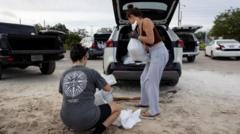
Hurricane Helene continues to strengthen as it barrels toward the US Gulf Coast.
The category one storm is on track to intensify quickly into a dangerous category four hurricane by the time it makes landfall in Florida on Thursday evening local time, with official forecasts and warnings describing its likely impacts as “catastrophic”, “life-threatening” and “unsurvivable”.
The governors of Florida, Georgia, North Carolina, South Carolina and Virginia have declared states of emergency ahead of the storm’s landfall.
Mexico’s Yucatán peninsula and the tourist resorts of Cancún and Cozumel were spared major damage when the hurricane skirted its north-eastern coast but failed to make landfall.
Torrential rains caused flooding in parts of the Mexican state of Quintana Roo.
Videos uploaded by tourists and locals in Cancún showed buses attempting to drive through flooded streets in the area where many of the city’s hotels are located.
But the state’s governor said there had been no casualties and officials reported that power was being restored to areas where it had been cut.
At 06:00 GMT, Helene’s maximum sustained winds had increased to 85 mph (140 km/h).
The US-based National Hurricane Center (NHC) said the category one hurricane was moving north at 12mph (19km/h) through the Gulf of Mexico and was expected to strengthen rapidly, threatening to unleash catastrophic winds and storm surge to the north-eastern Gulf Coast.
Hurricanes need sea surface temperatures of more than 27C (80F) to fuel them.
With exceptionally warm waters of the Gulf at 30-32C (86-89F), the sea surface is about two degrees Celsius above normal for the time of year.
This will supercharge Helene’s development and bring about what meteorologists call “rapid intensification”.
The NHC expects Helene to reach maximum strength as a category four major hurricane just before making landfall on Thursday evening local time in the Big Bend counties of Taylor, Jefferson and Wakulla.
It urged residents to rush their preparations to protect life and property before the hurricane’s arrival.
The National Weather Service office in Tallahassee said surges caused by the storm could reach a height of up to 6m (20ft) in Apalachee Bay in Florida.
It described these potential surges as “catastrophic and unsurvivable” for anyone caught in them.
Storm surges can also be life-threatening further inland, when floodwaters move inland from the coastline.
At a news conference, the mayor of Tallahassee, Florida, also warned residents to be prepared.
“We have no more time left to wait,” Mayor John Dailey said.
“We urge you to stay weather aware as we’re on the verge of what could be… a historic event.”
In Georgia, all public schools in Atlanta will close on Thursday and Friday because of the storm.
It has also affected the race for the White House, with the Republican candidate for vice-president, JD Vance, cancelling two events in Georgia that were planned for Thursday.
All across the south-eastern US, the storm could trigger “catastrophic and potentially life-threatening flash and urban flooding”, the NHC said.
The NHC has said that once it reaches the south-eastern United States, it is expected to “produce total rain accumulations of five to 10in” (12.7-25.4cm).
A flood watch has been issued from Florida to the southern Appalachians, with the worst-affected area predicted to be the Big Bend region in Florida.
Big Bend is where Hurricane Idalia made landfall in 2023. The area was also battered by Hurricane Debby last month.
The Florida Division of Emergency Management has posted a list, external of the counties in which voluntary or mandatory evacuation orders have been issued ahead of Helene.

